Post Wildfire Coordination
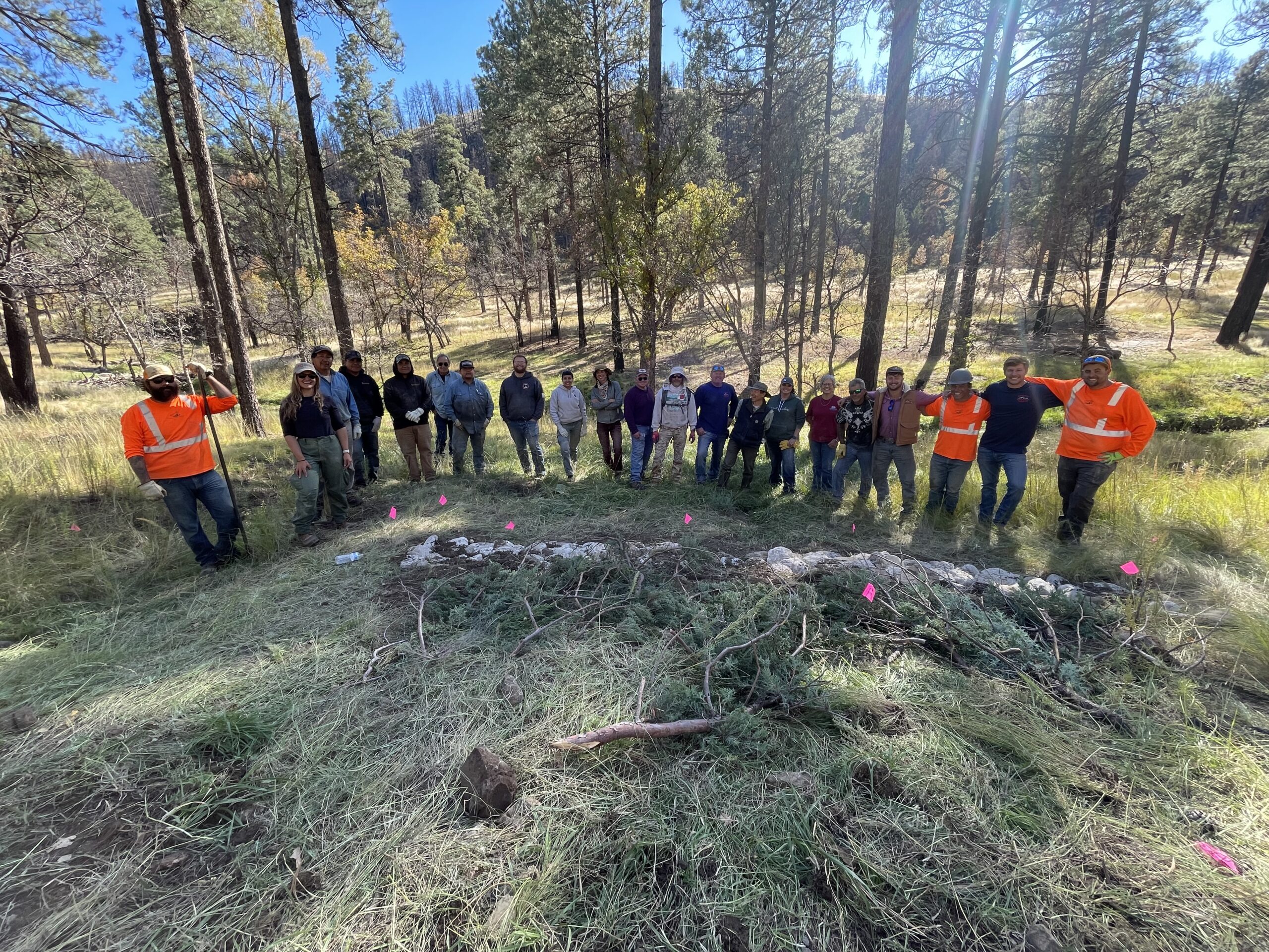
South Fork Fire – Watershed Stabilization Program
Incident Summary
The South Fork and Salt Fires, which ignited by lightning strike on June 17, 2025, burned 17,066 and 7,688 acres, respectively, significantly impacting the Lincoln National Forest Smokey Bear Ranger District, Mescalero Apache Reservation, and Village of Ruidoso. The fire was declared 99% contained by July 15, 2024. Approximately 1,400 homes and structures were destroyed in the incident and more than 150 have been destroyed by post-fire flooding.
More information, including an archive of press releases, can be found here.
The perimeter of the South Fork Fire burn scar can be accessed here.
The Presenting Issue
Wildfires dramatically change the landscape and ground conditions, which can lead to a higher risk of flooding and landslides. When a wildfire burns a portion of a watershed, the resulting burn scar increases the potential for flooding until vegetation is re-established. Natural, unburned vegetation and soil normally act as a sponge during a rainfall event. However, the heat from a fire can bake the ground, creating a surface that will not absorb water and can increase the speed with which water flows off the slope. When a wildfire compromises or eliminates these normal protective functions, the potential for significant flooding and debris flows increases.

Image description: An illustration depicting wildfire effect on flooding downslope. Image credit: Federal Emergency Management Agency, U.S. Army Corps of Engineers.
South Fork Fire Watershed Stabilization Program Overview
The State of New Mexico, Energy, Minerals and Natural Resources, Forestry Division (Forestry Division) is accepting requests for post-fire erosion and hazardous tree mitigation assistance from landowners impacted by the Salt and South Fork Fires. The Forestry Division is utilizing contractors who will conduct site assessments and carry out post-fire projects. The Forestry Division will have sole discretion to determine appropriate post-fire practices to be implemented on the landowner’s behalf.
Please be advised that the initial phase of property assessments for our post-fire recovery program has been completed, and our assessment contractors have demobilized. While we are no longer scheduling new assessments at this time, we encourage interested landowners to continue submitting their applications and supporting documentation. We anticipate additional funding for this crucial program in the future, which may allow us to remobilize contractors to conduct further assessments. Please understand, however, that the resumption of assessments cannot be guaranteed at this time.
Eligibility
Landowners requesting assistance will be evaluated for eligibility based on the following criteria:
- The property must be located in Lincoln County and within the boundaries of the South Fork burn scar
- It is the responsibility of the landowner or their representative to provide evidence of property ownership by providing plats, deeds, and/or title insurance. Please note that proof of ownership documents must have the name of the current landowner and the address, legal description, and/or UPC number of the property for us to verify ownership. To meet these requirements, we can accept the following documents:
- Property tax statement, including a Notice of Value document, or title insurance. Please note: a Notice of Value document is easiest to verify, as it includes physical address, UPC, and legal description.
- Warranty deed
- A notarized plat with ownership details (i.e. the name of the current landowner)
- Trust agreement or certification of trust, if applicable
- Hazard trees on the property must be located within a distance that is twice the tree’s height from roads and/or structures. Hazard trees include disaster-damaged trees that:
- Are leaning more than 30 degrees;
- Have more than 75% canopy damage for ponderosa pines, or more than 50% canopy damage for other tree species;
- Have split trunk exposing the heartwood, or
- Have 40% exposed roots.
Areas of Priority
Properties will be prioritized for assistance to maximize long-term watershed recovery, focusing on areas with the greatest risk of erosion that may contribute to debris flows and impact downstream communities. Prioritization will be based on:
- Proximity to other landowners who have requested assistance will receive priority. This will enable the Forestry Division to use funding efficiently by reducing contractor mobilization costs.
- Location in a watershed, with areas higher in the watershed receiving priority.
- Burn severity, with higher burn severity properties receiving priority.
- Terrain features, with areas having steeper slopes receiving priority.
These standards ensure that the New Mexico Forestry Division does not violate the State’s Anti-Donation Clause, which specifies that State funding cannot be used to directly benefit an individual landowner. To ensure the Division is following the Anti-Donation Clause, we must prioritize using State funds to provide public benefit.
The Program
The Forestry Division will receive the landowner’s requests and verify eligibility.
- The landowner will complete a Right-of-Entry Agreement which gives the Forestry Division and its contractors permission to enter the property for the purpose of conducting hazard tree mitigation and post-fire erosion control.
- A planning contractor will contact the landowner to schedule a site visit and develop a map indicating which trees are eligible for removal, sites chosen for erosion control structures, and how slash (tree residue) will be treated.
- The planning contractor will submit the plan to the Forestry Division which will identify recommended post-fire practices for the property.
- The Forestry Division will review the plan and work with the planning contractor on any necessary revisions.
- The Forestry Division will engage project contractors to implement approved plans.
- Work can begin on the landowner’s property in accordance with approved plans.
Relevant Program Documents and Links
Application Status Lookup Spreadsheet:
We are hard at work developing this tool. We will alert landowners once it is up and running.
Below you will be able to look up your application status by application number. Please follow the instructions in the footnote below to find your application number. Applicants should expect this information to be updated every 3-4 weeks as staffing time allows, or when there are major developments in project implementation.
**Decoding application statuses:
- Application received – Your application is in our tracking system but has not yet been processed. Properties prioritized for treatment will be contacted by a project forester or contractor to inform them of the anticipated timeline for the property visit.
- Assessment complete – Your property assessment is complete and a draft practice plan has been completed.
- Implementation plan complete – Contractors have translated your property’s draft practice plan into an actionable implementation plan. You will receive a copy of this plan once it is completed and reviewed and approved by Forestry Division staff prior to implementation.
- Implementation in-progress – Contractors will reach out to schedule a time to begin implementing project work on your property.
- Implementation completed – Congratulations! Your property is now playing an integral role in watershed protection for your community!
How to Sign Up
If you have not yet signed up for the Salt-South Fork Watershed Stabilization Program through New Mexico Forestry Division, you can find additional information and apply for assistance here.
If you need assistance with your application, please contact us at emnrd-southfork@emnrd.nm.gov to schedule a time to discuss the application process.
Please do not submit more than one application for the same property, as it can cause issues with our internal tracking systems. Submitting multiple applications will not alter our prioritization process. If you are unsure whether you have an active application through this program, please contact us at emnrd-southfork@emnrd.nm.gov.

A contour felling project funded through the South Fork Watershed Stabilization Program in Ruidoso, NM. Contour logs help to trap sediment and seeds during precipitation events, stabilizing soil to allow for plant regrowth in burned areas. Image credit: Ethan Seavey.
Additional Post-Fire Resources and Supporting Organizations
Following wildfire, land can take time to heal to the point where it can support and grow seedlings. In the first 2-3 years following fire, we encourage landowners to focus on stabilizing soil through erosion control practices before replanting.
New Mexico Forestry Division
- New Mexico Forestry Capitan District – The Capitan District spans the southeast corner of the state. It is comprised of Chaves, De Baca, Eddy, Lea, Lincoln, Otero, and Roosevelt Counties. The district provides technical assistance to landowners and has wildland fire suppression responsibilities that cover 30,877 square miles, encompassing nearly 8.6 million acres of private, non-federal, and non-municipal lands. The staff provides leadership and technical assistance on forest and watershed health projects, as well as fire safety issues.
- Reforestation Program – There is a shortage of suitable reforestation seedling providers in the southwest. To meet this need, NMFD is supporting The New Mexico Reforestation Center in scaling up seedling production in the coming years. NMFD is developing programs and resources to make these seedlings available to landowners and guide reforestation planning for the South Fork/Salt burned areas. Prior to planting seedlings, we recommend 1) connecting with the NMFD Capitan District Office to begin planning, 2) prioritize practices that stabilize the soil such as planting native grasses or shrubs, and 3) checking in with our Reforestation and Reforestation Resources page to learn more about reforestation and stay up to date on developing programming.
- Conservation Seedling Program – The Forestry Division offers low-cost seedlings to landowners to plant for reforestation, erosion control, windbreaks, streambank restoration, and wildlife habitat improvement. You can order seedlings from this program twice per year – generally beginning the first week of July and the first week of October. Because of the popularity of this program, we recommend planning ahead and being ready to submit your order as soon as the ordering period begins. Because the minimum order size is 49 seedlings per species, you may want to consider coordinating with neighbors or other community members to pool your orders. It is important to choose native shrub and tree species adapted to your location. For more information, please visit the Conservation Seedling Program page.
State, Municipal, and Non-Profit Resources
- New Mexico Department of Homeland Security and Emergency Management (DHSEM) – Private Property Debris Removal is a State of New Mexico coordinated program to remove debris from flood impacted properties. Services through DHSEM are free. To learn more, you can call Disaster Case Managers at 505-670-4662 or visit the Post-Fire and Flood Debris Removal Program website.
- American Forests – American Forests is the nation’s oldest conservation non-profit. The organization supports landowners impacted by wildfire by conducting one-on-one site visits and providing guidance on best management practices for reforestation. Staff with American Forests can also help develop climate adapted reforestation plans and create planting prescriptions for contractors to implement. For more information and to schedule a site visit, contact landownersupport@americanforests.org.
- South Central Mountain Resource Conservation and Development Council (SCM RC&D) – SCM RC&D is a non-profit that works collaboratively with area partners to bring resources and support to the residents of Lincoln and Otero Counties. SCM RC&D is serving as the lead local sponsor overseeing the NRCS Emergency Watershed Protection Program. To learn more about how the SCM RC&D Council can assist, contact Laura Doth at laura@scmrcd.org.
- Upper Hondo Soil and Water Conservation District – Upper Hondo educates and informs the public on programs available to them for soil and water conservation practices as well as noxious weed eradication. They offer cost share plans for those who qualify in the areas of brush control, erosion control, pipelines, dirt tanks, cross fencing and rainwater harvesting. The District has specific grass seed mixes designed for post-fire stabilization, which they sell to community members with instructions for the best germination rates. For more information, call 575-354-2220 or visit their website.
Resource Library
Recovery and Restoration
- After Wildfire: A Guide for New Mexico Communities – This guide was written to help New Mexico communities recover after wildfire. It includes information on mobilizing your community, a list of resources available to communities and individuals for assistance, and a technical guide with information about post-fire treatments to address the catastrophic effects of wildfire on the land and to prepare for potential flooding. An effort is currently underway to
- FEMA Flood After Fire Toolkit – Social posts, infographics, videos, and more resources explaining why wildfires pose increased flooding risk for up to 5 years post-fire.
Best Management Practices for Ecological Restoration
- Contour Felling Landowner Guide – After severe fires, few trees or plants are left to hold soil in place, leading to erosion. Felling and anchoring burned trees along slope contours is one way to reduce erosion and stabilize slopes using materials on-hand. This guide provides an overview of contour felling principles and tips.
- After the Fire: Bark Beetle Management – Bark beetles are a native decay agent found in many southwestern forests. Bark beetles typically attack weakened trees when their defenses are poor. Although destructive, the appetite of bark beetles naturally increases the diversity of tree age and tree size across the forest. After a major wildfire disturbance or drought, however, populations can swell and attack healthy trees. This document lays out bark beetle biology and life cycle, identification and assessment of colonized trees, and management strategies.
Additional resource guides can be accessed by following the links below:
Mental Health and Legal Support Services
- Legal Aid Disaster Resource Center: New Mexico South Fork Fire and Salt Fire – Provides a repository of safety and shelter resources, legal assistance, and news and information regarding the South Fork and Salt Fires and other natural disasters.
- New Mexico Crisis and Access Line – Whether you’re feeling overwhelmed, struggling with stress, or just need someone to talk to, trained professionals with the New Mexico Crisis and Access Line are ready to listen – 24/7, free, and completely confidential.
- Call 1-855-NMCRISIS (662-7474) and/or dial 988
- Disaster Distress Helpline – The first national hotline dedicated to providing year-round disaster crisis counseling. This toll-free, multilingual, crisis support service is available 24/7 to all residents in the U.S. and its territories who are experiencing emotional distress related to natural or human causes.
- Call or text 1-800-985-5990.
- Si habla Español: Llama o envía un mensaje de texto 1-800-985-5990 presiona “2.”
- For Deaf and Hard of Hearing ASL Callers: Please text or call the Disaster Distress Helpline at 1-800-985-5990 using your preferred Relay provider.
Wildfire Preparedness and Education
- Living with Fire Guide New Mexico – Provides recommendations and resources to homeowners, educators, community groups, and firefighting professionals to prepare for wildfire and reduce wildfire threats to homes and communities.
- Firewise USA – Provides simple, effective steps to help communities reduce the risk of destruction from wildfire.
- Fire Adapted Communities Learning Network (FAC Net) – People learning and working together are the foundation of fire adaptation. FAC Net invests in people and in place-based efforts to change relationships with fire.
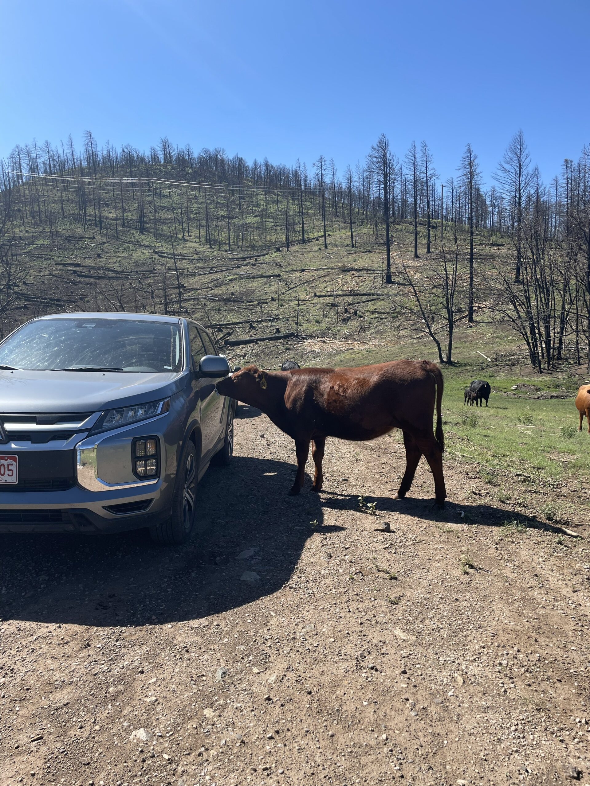
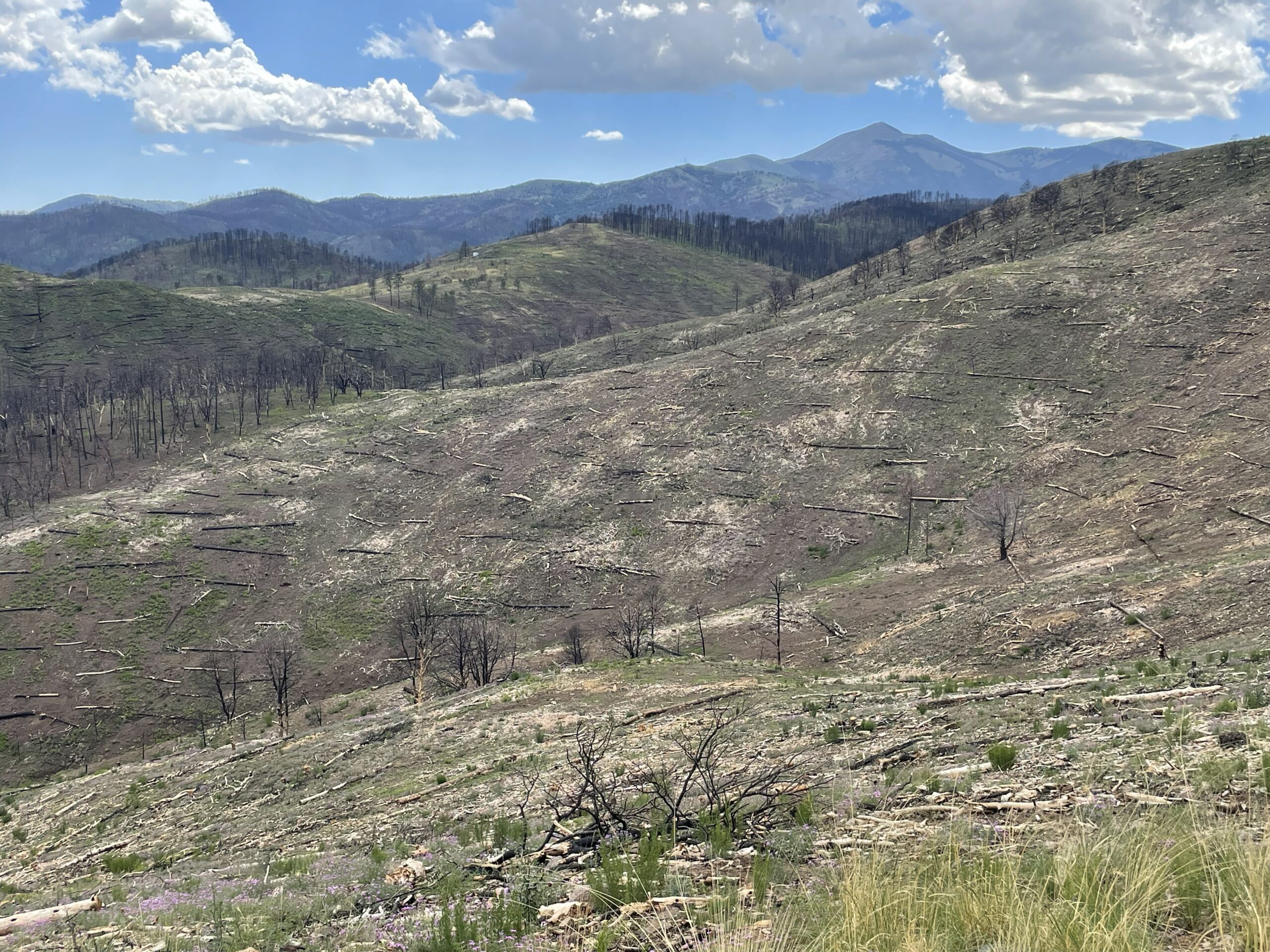
Contact us
If you have any questions regarding the program or your application status, please contact us at emnrd-southfork@emnrd.nm.gov.