Community Wildfire Protection Plans (CWPP)
Community Wildfire Protection Plans (CWPP)
Communities can take proactive steps to protect themselves from dangerous and damaging wildfire. The Forestry Division works with New Mexico Counties and federal land management agencies to assist counties and communities to plan ahead for wildfire. See below for available resources and contact your local Forestry Division office for additional information.
Community Wildfire Protection Plans (CWPP) are authorized and defined in Title I of the Healthy Forests Restoration Act (HFRA). Federal and state funding for hazardous fuel reduction projects is dependent on whether a county or community has a signed and approved CWPP.
CWPP’s have three main components: (1) Collaboration with all stakeholders throughout the CWPP process, (2) Identification and prioritization of hazardous fuel reduction areas, and (3) addressing the treatment of structural ignitability within the CWPP area. The New Mexico Fire Planning Task Force reviews new and updated CWPPs by December 1st of each year.
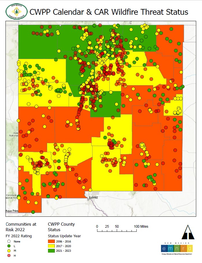
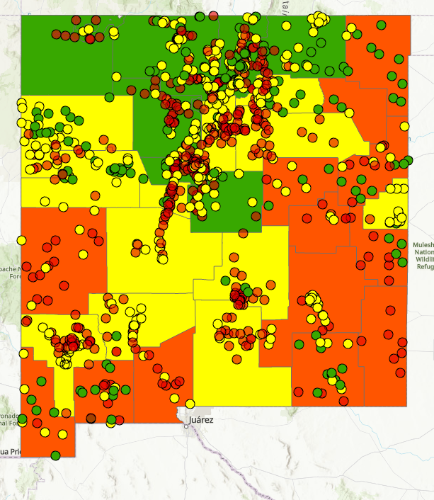
Communities At Risk Interactive Map
This interactive map displays New Mexico Communities at Risk, along with their wildfire threat status.
It also provides a CWPP calendar for all participating communities, showing what year the last update took place.
County and Community CWPPs
Below is a list of county and community CWPPs within the state of New Mexico.
| County | County CWPP | Community CWPP |
| Bernalillo | Bernalillo County | |
| Catron |
Catron County |
|
| Chaves |
Chaves County |
|
| Cibola |
Cibola County |
|
| Colfax |
Colfax County |
Vermejo Park+ |
| Curry |
Curry County |
|
| De Baca |
De Baca |
|
| Dona Ana |
Dona Ana |
|
| Eddy |
Eddy County |
|
| Grant |
Grant County |
|
| Guadalupe |
Guadalupe County |
|
| Harding |
Harding County |
|
| Hidalgo |
Hidalgo County |
|
| Lea |
Lea County |
|
| Lincoln |
Lincoln County |
|
| Los Alamos |
Los Alamos County |
Los Alamos County |
| Luna |
Luna County |
|
| McKinley |
McKinley County |
Candy Kitchen |
| Mora |
Mora County |
|
| Otero |
Otero County |
|
| Quay |
Quay County |
|
| Rio Arriba |
Rio Arriba County |
|
| Roosevelt |
Roosevelt County |
|
| San Juan | N/A | San Juan Basin |
| San Miguel |
San Miguel County |
|
| Sandoval |
Sandoval County |
Middle Rio Grande* |
| Santa Fe |
Santa Fe County |
City of Santa Fe+ Glorieta Estates+ |
| Sierra |
Sierra County |
|
| Socorro |
Socorro County |
|
| Taos |
Taos County |
|
| Torrance |
Torrance County |
|
| Union |
Union County |
|
| Valencia |
Valencia County |
Middle Rio Grande* |
*encompasses areas in Bernalillo, Sandoval, Socorro and Valencia Counties
**encompasses areas in Cibola and McKinley Counties
***encompasses areas in Colfax and Taos Counties
#encompasses areas in Lincoln, Socorro, and Torrance Counties
+CWPP in progress
For more information on developing a CWPP for your community, contact your local Forestry Division District office listed below.


